|
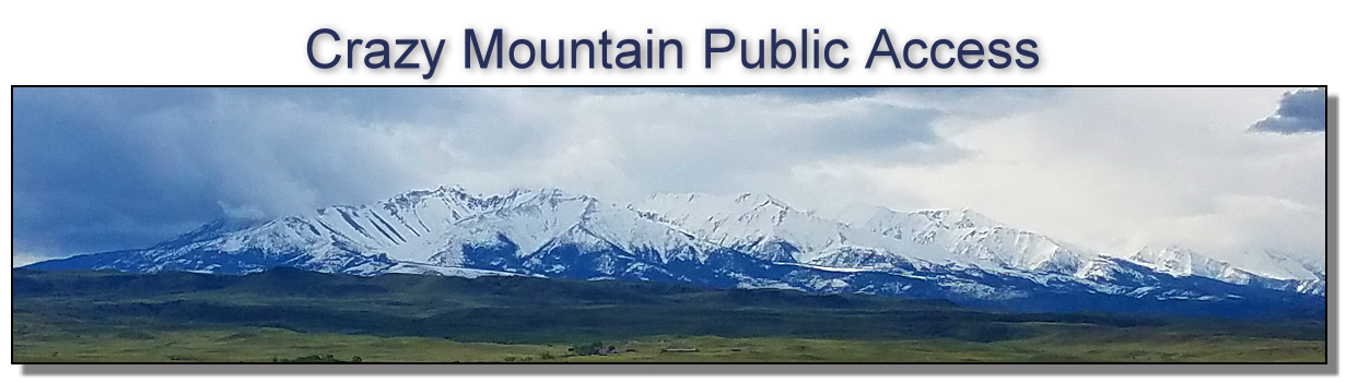
EAST CRAZY
MOUNTAINS Public Comments
deadline is December 23, 2022 11:59:59 PM (MST)
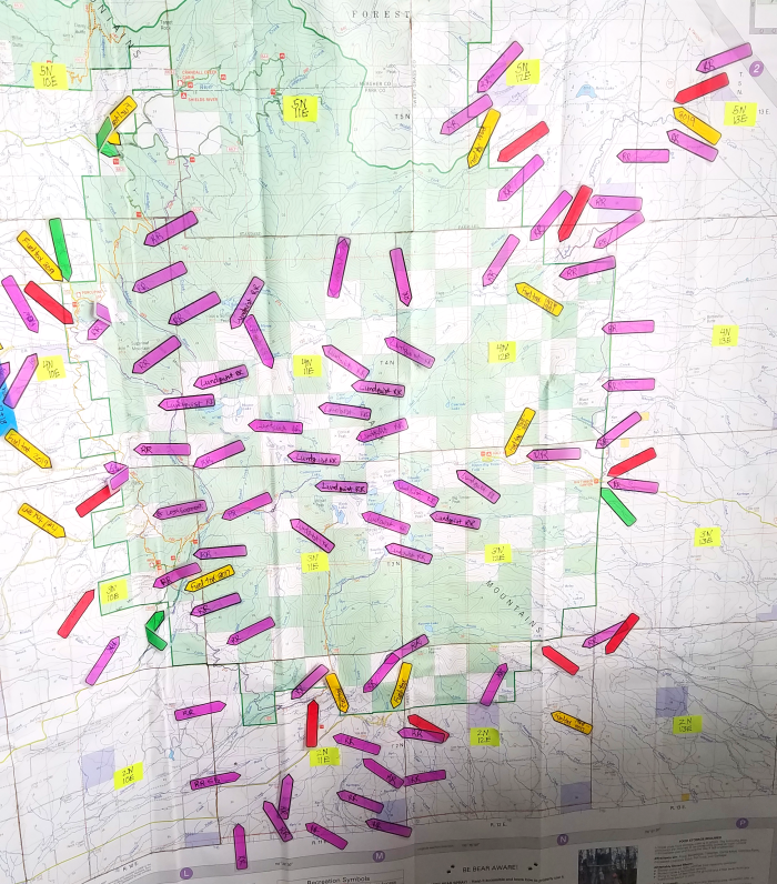
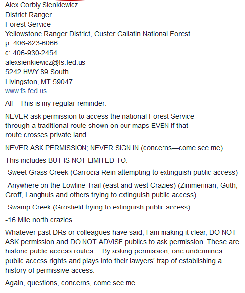
FS FOIA documents show the FS was actively seeking RR grants deeds with easement language, they were like gold, when they found them - this is property law, you can't just ignore it. Pay attention, also, to the water, mineral and timber rights language in each deed. The big question, why does this land exchange not have an option for the FS to defend our already existing historical public access??? Crazy Mountain FS Map with trails Recently touted as a “made-in-Montana compromise”, the 3rd land exchange proposal, this time on the east-side of the Crazy Mountains, is anything but – let's call it what it is – a big money sellout. Please REJECT this East Crazy Inspiration Divide Land Exchange #63115 - Alternative A - No Action Due to long-covid complications, I cannot do the detailed heavy lifting on breaking down all the necessary points on this exchange. I will focus on the Railroad Grant Deeds and other evidence of historical public access we already have that the FS is abandoning, like the public schools that were there. BHA has done a great breakdown (link below) of the Preliminary Environmental Assessment (PEA) points, so I will link to those for readers to include in their comments. BHA PEA points - OPPOSING THE EAST CRAZIES LAND SWAP: WHAT YOU NEED TO KNOW Guest Opinion - Reject East Crazy Mountains land swap proposal - Please join the following local, state and national conservation organizations in rejecting this proposal. Park County Rod and Gun Club (Livingston based), Friends of the Crazy Mountains (Livingston based), Montana Chapter of Backcountry Hunters & Anglers, Enhancing Montana’s Wildlife and Habitat, Montana Public Trust Coalition, Helena Hunters and Anglers, Hellgate Hunters and Anglers, Montana Sportsman’s Alliance and Skyline Sportsmen. EMWH Historical & RR Grant Deed Points - One of my key points here (pg 4 of the Preliminary Environmental Assessment (PEA), is the Forest Service's 2017 abandonment from defending our Crazy Mountains public access that WE ALREADY HAVE, to backing these landowners in their privatization of access. The FS states, "The proposal respects the status quo regarding permissive public access into the upper Sweet Grass Creek drainage over Rein Lane. The landowners have indicated that they intend to continue allowing permissive seasonal access across the private lands they own, so long as private property is respected." Prior to this, the FS adamantly maintained these were historic prescriptive easements with public access. The FS is has been abandoning our long-held public access. Evidence below (just tip of the evidence iceberg).
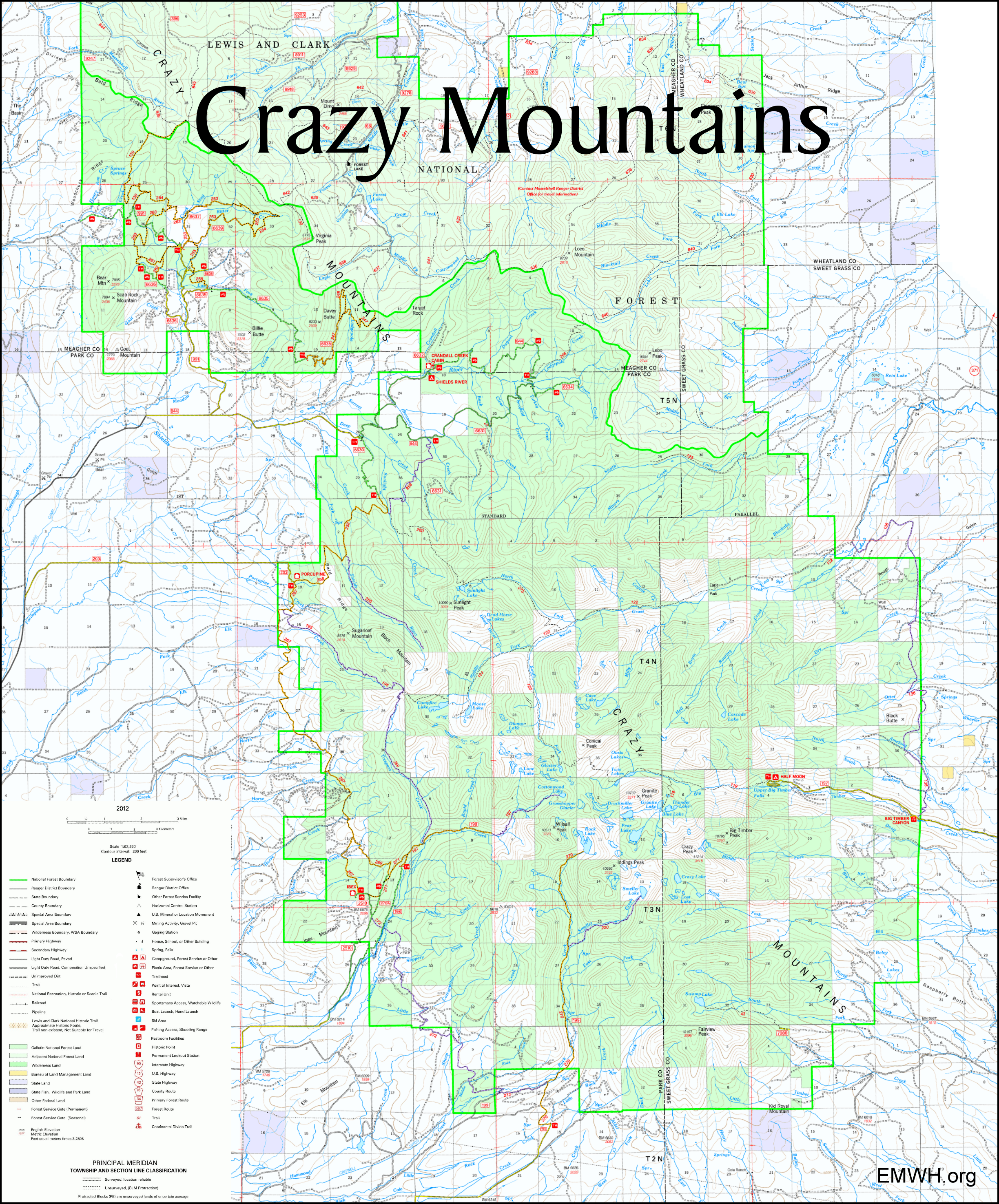
B. FS Supervisor Mary Erickson's letter to Senator Steve Daines Oct. 2, 2015, "It is a historic trail that dates back a century or more. The Forest Service maintains that it holds unperfected prescriptive rights on this trail system as well as up Sweet Grass Creek to the north based on a history of maintenence with public funds, and continued public and administrative use." C. Regional Forester Hal Salwasser letter to Senator Conrad Burns, Mar. 6, 1996, "...it is our position that the United States has an easement interest due to historic public and administrative use and maintenance." D. U.S. v. Paul L. Van Cleve 1948 Big Timber Canyon Road legal case based on 1 section of a Railroad Grant Deed. Esp. pdf pags. 70 & 71, sections V & VI. Black's Law Dictionary defined Highway as, "A free and public road, way, or street; one which every person has theright to use. In all counties of this state, public highways are roads, streets, alleys, lanes, courts, places, trails, and bridges, laid out or erected as such by the public." This case is foundational, with regard to the Railroad grant deeds with public easement language. Railroad grant deeds and other historical documents like public schhol on Sweet Grass documents, are linked on the left sidebar. "VI. That the United States has a special right, title and interest in said highway and trail and all parts thereof, including the parts thereof situated upon lands now owned by the defendants, amounting to an easement and right-of-way for said purposed by reason of the facts that said road and trail were established upon said land when it was in part public land of the United States of America and in part in the ownership of the Northern Pacific Railroad Company... which said railroad company and railway company dedicated the same public highway, which was appropriated by the United States and the general public prior to the issuance of any patents therefor, thereby reserving unto itself and the general public said public highway, road and trail, and by reason of the fact that the United States and its permittees and the public have for more than 50 years used said road and trail for said purposes and the United States has, during said period from time to time, expended upon said road and trail monies appropriated by Congress, for its contruction and maintenance to the end that it might serve said purposes; and the United States in common with the public is entitled to the possession of the right-of-way for said highway and that the same necessary for the protection, use and administration of the national forest and other property of the United States." "V. That at all times mentioned herein, there has existed and there now exists a public highway, viz., a road and trail in and along the canyon of Big Timber Creek entering said Crazy Mountains Division of said natioanl forest across the east boundary line... of NE1/4 of the NE1/4 of section 12, Township 3 North, Range 12 East, extending westerly... and through and across Sections 1, 2, 3, 4, 5 and 6 of said township and range, and thence westerly, then northerly to a point near the center of Township 4 North, Range 11 East where it joins the Sweet Grass Trail situated in the Sweet Grass Canyon ...and the upper drainage of Sweet Grass Creek for the use by the general public at large of the recreational areas, camp grounds, parks, and facilities of said national forest, and by the United States of America on behalf of the general public at large pursuant to the laws of the United States and the regulations of the Secretary of Agriculture relating to the protection, use and administration of the natioanl forest." From Big Timber on the East Crazies, thru Half Moon Campground, west on Trail #119 to Section 34 of 4N 11 East by Glacier Lake, then northerly on the S. Fork of Sweet Grass Trail #122, to the main Sweet Grass Trail, going east, connecting to the East Trunk Trail # 115/136, then south back to Big Timber, we already have a loop that the public has been using for about 100 years. Why would we abandon this? With this exchange, through the USFS, the public abandons any claim of the historic access up Sweet Grass Trail, one of very few important access points from the east into the Crazies. This will result in an ever-growing number of users all funneled through a single trailhead in the southeastern portion of the Crazies. The public will be quickly pushed off the rolling hills and productive habitat of the low country and relegated to the steep, high terrain largely consisting of rock and ice. The landowners, however, receive the valuable and productive low land.
Background For the public trust's sake, you just might want to know some of the details behind it, tip of the iceberg, and how these land exchanges are shrinking the Crazy Mountains. The East-Side Crazy Mountains Trail Relocation Proposal was worked up by Tom Glass of the Yellowstone Club, for the "working group" to present to the Forest Service. On February 10, 2020, I, Enhancing Montana's Wildlife & Habitat, attended a private meeting requested by Tom Glass (Western Land Group, Inc. representing the Yellowstone Club) and Jess Peterson (Western Skies Strategies), with our Friends of the Crazy Mountains plaintiffs and attorneys, involving a proposed eastern Crazy Mountains land exchange between private landowners and the Custer Gallatin National Forest. Glass explained that the Yellowstone Club was in discussions with Custer Gallatin National Forest Supervisor Mary Erickson, on a proposed land exchange in Big Sky. Glass was informed that the land they offered the FS, was not an equal exchange, that they would need to come up with the balance. Glass then stated that FS Supervisor Mary Erickson directed them to look to the Crazy Mountains to come up with the value balance needed. My FOIA requests confirm Glass met with Supervisor Erickson and Regional Forester Leanne Marten, during the stated time period. Glass also stated they did not believe that a NEPA process would need to be conducted and they were leaning towards a Congressional exchange, rather than administrative. Afterward, Glass registered as a Congressional lobbyist, on behalf of Yellowstone Development, LLC, on March 1, 2020, to lobby on “Land Exchange Legislation”. Not only does a legislative exchange potentially steamroll the process, it can also reduce opportunities for public involvement – a great concern to me as a public trust advocate. Additionally, during the presentation, Glass and Peterson repeatedly made statements, as to the landowners status and rights, which contradict public access research I've done, involving existing public access in the Crazy Mountains: historical prescriptive easements, Northern Pacific Railroad grant deeds with public access, and RS2477 public access. Not only does this east-side land exchange diminish the approximate 100 year old existing trail system, it also moves trails to much steeper elevations, limiting the users who can physically access the trails. This proposal, as the others, seriously ignores that the public already HAS ACCESS, if only the FS would simply do their job to defend it from private landowner obstruction. Taken as a whole, between the east and west-side exchange being litigated, the proposed southern exchange, now the east proposal, we are seeing the inexcusable shrinking of the Crazy Mountains, a theft from the public's hands.
|
Enhancing Montana's Wildlife & Habitat
|
Copyright © 2022 Enhancing Montana's Wildlife & Habitat (EMWH) reserves the rights for images, other graphics, videos (visual media), excluding maps, at this site. You may not reproduce any of the visual media content on this website, without the permission from EMWH. Visitors are strictly prohibited from using EMWH's Website and its Content for fraudulent, illegal, threatening, libelous or defamatory purposes, or any communications and/or materials that could give rise to civil or criminal liability under law." |
Site designed and maintained by Kathryn QannaYahu